Mediterranean islands
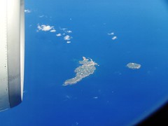
 Photo (© hytam2)
View on Flickr

 Google Earth Screenshot
View in GE
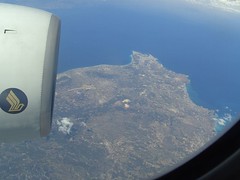
Ventotene and Santo Stefano Islands, Italy
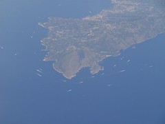
This series of photos from Flickr user hytam2 shows the Mediterranean islands and coastlines of Italy and Greece. The first image shows the small Italian islands of Ventotene (left) and Santo Stefano, located off Italy's west coast, about 70 km west of Naples. Ventotene is home to around 660 people; Santo Stefano is uninhabited today, but formerly housed a massive prison which operated until 1965. The prison is visible near the center of the island in the high-resolution version of the photo.
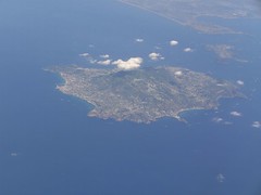

The next image shows the volcanic island of Ischia, about 30 km west of Naples and home to about 58,000 people. In the upper right is the smaller island of Procida, and beyond that, the town of Bacoli on the Italian mainland.
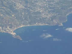

Next we have a close-up of the southern coast of Ischia, showing Maronti Beach in the center, with the cape of St. Angelo on the left.
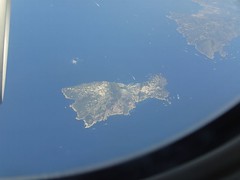

Another 30 km to the southeast, we have this view of the island of Capri. The city of Capri lies on the narrower neck of the island to the right; the smaller town of Anacapri lies on the left, west of Mt. Solaro.

Just east of Capri, the next image shows the tip of the Sorrentine Peninsula, with the city of Sorrento visible in the upper center.
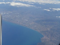
Further south, across the Gulf of Salerno, we see this view looking northeast across the Italian coastline. The city of Agripoli is in the lower right, and the ancient Greco-Roman city of Paestum, a UNESCO World Heritage site, lies along the coast near the center of the photo.
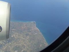

We now cross over Calabria, the toe of the Italian boot, to this image of cape of Punta Alice, on the edge of the Gulf of Taranto. On the right, just below the cape, is the town of Cirò Marina.
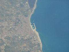

Here's a close-up view of the harbor in the town of Cirò Marina.

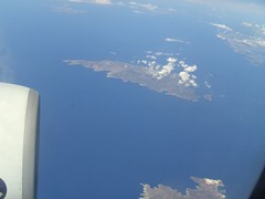
We now proceed another 600 km to the southeast, across the Ionian Sea, to the Greek island of Hydra off the southeastern coast of the Peloponnese.

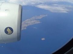
Next we have the island of Serifos in the western Cyclades, home to about 1,200 people. In the background is the smaller island of Serfopoula (Little Serifos).

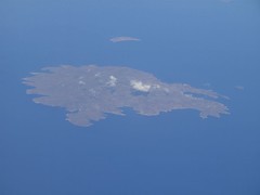
Just east of Serifos is the island of Sifnos, with the northern cape of the island of Milos visible in the foreground.

Finally, we reach the eastern extreme of the Greek islands with this view of the city of Rhodes on the northeastern tip of the island of Rhodes. The coast of Turkey is faintly visible in the upper right, about 18 km from Rhodes.
Photos taken: May 20, 2007
Photos by: hytam2
Route: Unknown